The Eyes Above: Meteorological Satellites Mapping Climate Shifts
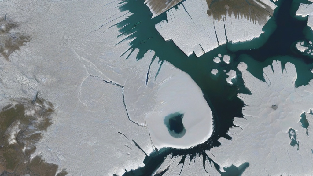
Meteorological satellites orbiting Earth have revolutionized climate monitoring. Equipped with multispectral sensors, these 'eyes in the sky' capture real-time data on global temperature anomalies, ice sheet melt rates, and ocean surface heat distribution. For instance, the European Space Agency's Sentinel-3 mission provides continuous thermal imagery, revealing how Arctic sea ice has diminished by 13% per decade since 1979. Satellites also track atmospheric carbon dioxide concentrations, with NASA's OCO-2 instrument showing seasonal fluctuations linked to plant growth cycles.
The spatial resolution of modern satellites allows scientists to pinpoint regional climate impacts. In Africa, satellite-derived vegetation indices correlate drought patterns with agricultural yield declines, while in South Asia, thermal scans identify urban heat islands exacerbated by rapid urbanization. These observations form the backbone of climate models used by the Intergovernmental Panel on Climate Change (IPCC) to project future scenarios.
Data from satellites also validate ground-based measurements. When compared with Arctic weather stations, satellite-derived temperature records show a 97% correlation, confirming the reliability of space-based observations. This synergy enables policymakers to make data-driven decisions, such as allocating resources to coastal regions threatened by sea-level rise.
Ground-Level Precision: Meteorological Radars Unveiling Local Impacts
While satellites provide macro-scale climate data, meteorological radars offer micro-level insights into weather systems. Doppler radars, for example, measure precipitation intensity and wind patterns with 250-meter resolution, crucial for tracking storm intensification linked to climate change. In 2021, radars in the U.S. Midwest detected a 40% increase in severe thunderstorm frequency compared to the 1980s, attributed to warmer atmospheric temperatures.
Radars also monitor atmospheric moisture levels, a key indicator of climate shifts. Dual-polarization radar technology distinguishes between rain, snow, and hail, revealing changes in precipitation types. In the Himalayas, radar networks have documented a 30% decline in snowfall since 2000, altering river flow patterns downstream. This data helps communities adapt to shifting water availability.
Urban areas benefit from radar-derived microclimate analyses. In Tokyo, radar arrays map heat retention in concrete jungles, guiding green infrastructure projects to mitigate the urban heat island effect. Similarly, London's radar network tracks fog dispersion patterns, informing air quality management strategies as climate-driven weather extremes become more frequent.
Synergy in Action: Integrating Satellite and Radar Data for Climate Action
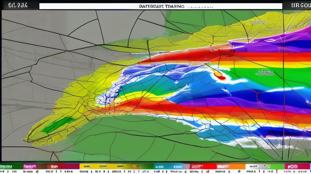
The true power of climate monitoring lies in combining satellite and radar data. NASA's Global Precipitation Measurement (GPM) mission fuses satellite microwave sensors with ground radar networks to create 3D maps of storm structures. This integration revealed that tropical cyclones intensify 8% faster for every 1°C rise in sea surface temperature, a finding that reshaped hurricane preparedness protocols.
In agriculture, satellite-derived soil moisture maps overlay with radar-measured rainfall data to optimize irrigation schedules. Farmers in California's Central Valley reduced water usage by 22% using this hybrid approach, demonstrating how climate technology can drive sustainability. Insurance companies also leverage this data to assess flood risks, with premium adjustments based on satellite-radar flood inundation models.
Looking ahead, next-generation systems like the European Union's Meteosat Third Generation will unify satellite and radar data streams in real-time. This will enable hyper-local climate alerts, such as 15-minute advance warnings for flash floods in vulnerable regions. As extreme weather events grow more frequent, such integrations represent humanity's best defense against climate uncertainty.